Vermont--The Molly Stark Trail
Date: 2004-12-12
 What is now Vermont Route 9 was the route taken by General Stark as he
lead his troops across Vermont to defeat the British, August 1777. To
confuse the enemy, General Stark referred to the route they were taking
as, "The Molly Stark Trail." Molly was both a nurse and doctor to her
husband's troops during a smallpox epidemic, using their house as a hospital.
You may see some of what Molly Stark may have seen when her husband John
fought the Battle of Bennington, but we guarantee that your passage along
the Molly Stark Trail will be easier than a trek along this route would
have been at the time of the Revolutionary War.
What is now Vermont Route 9 was the route taken by General Stark as he
lead his troops across Vermont to defeat the British, August 1777. To
confuse the enemy, General Stark referred to the route they were taking
as, "The Molly Stark Trail." Molly was both a nurse and doctor to her
husband's troops during a smallpox epidemic, using their house as a hospital.
You may see some of what Molly Stark may have seen when her husband John
fought the Battle of Bennington, but we guarantee that your passage along
the Molly Stark Trail will be easier than a trek along this route would
have been at the time of the Revolutionary War.
Start in the town of Bennington at the Bennington Arts Center, the Old First Church where Robert Frost is buried or the Bennington Battle Monument, the tallest human-built structure in the state. Ride the elevator to the observation deck to get your bearings. There's also the Grandma Moses's Gallery, with its collection of works by the famous folk artist. As you continue east on Route 9, look out for the 1889 silk-covered bridge on Silk Road, spanning the Walloomsac River. Just inside the Green Mountain National Forest, you'll come to the town of Woodford Hollow with great restaurants and shops--including the Molly Stark Antique store. If you'd rather hike than shop, you'll find plenty to do at Woodford State Park with its numerous hiking trails as well as private and public campgrounds.
The town of Wilmington is next. Stop at the Mount Snow Valley Chamber of Commerce for a walking tour guide to this historic town. Settled in 1831 and home to the Hoosac Tunnel and Wilmington Railroad, it has plenty of specialty shops and antique stores. Check out Norton House for handmade quilts and other Vermont treats. East of Wilmington is the Molly Stark State Park, another public campground. Next, Route 9 passes through the town of Marlboro, (named for the Duke of Marlborough), before continuing to West Brattleboro, where you'll find the 1879 Creamery Covered Bridge. The drive ends a little farther east in the town of Brattleboro, where you can shop at the Outlet Center or your choice of antique stores; or you may opt for a visit to the Brattleboro Museum and Art Center. For a more literary side trip, take a left onto Black Mountain Road at the junction of U.S. 5 to Kipling Road, where you'll find Naulahka, Rudyard Kipling's home for several years. He wrote Captains Courageous and The Jungle Books here.
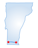
Starting Point:
Bennington, VT
Distance of Drive:
46 miles
Must Eat:
Marina Restaurant
28 Springtree Road, Battleboro, VT 05301
Phone:802-257-7563
Call ahead to confirm hours of operation.
Good Stop For: Hamburgers
and pasta
Best Time of Year for Drive:
Spring to Late fall--great colors in the fall
Points of Interest on Drive:
Bennington Arts Center
Brattleboro Museum and Art Center
Grandma Moses's Gallery
Comments to this article have been disabled.