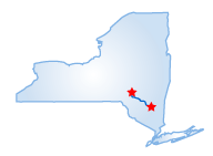
New York--Catskill Mountain Drive
Date: 2004-12-08
 The Catskill Mountains have been celebrated in paintings for their gentle
slopes and serene trout streams. The drive starts just west of Kingston
on Rte. 28. Travel six miles down this heavily commercialized area to
Rte. 375 until you reach the famous artist town of Woodstock, made famous
by the 1969 music festival that actually was held 50 miles southwest.
The Catskill Mountains have been celebrated in paintings for their gentle
slopes and serene trout streams. The drive starts just west of Kingston
on Rte. 28. Travel six miles down this heavily commercialized area to
Rte. 375 until you reach the famous artist town of Woodstock, made famous
by the 1969 music festival that actually was held 50 miles southwest.
Return to Rte. 28 and pass along the Kenozia Lake and the Ashokan Reservoir, part of New York City's water supply system. Rte. 28 follows portions of Esopus Creek, a Hudson River tributary and home to a variety of wildlife. A right turn off Rte. 28, near the village of Shandaken, will put you on Rte. 42 and lead you to the Belleayre Mountain Ski Center, near the town of Pine Hill. This is a state-run facility that is open to hikers in the off-season (lifts operate in the winter) and offers spectacular mountain views from the base lodge at 2,541 feet. Catch an even better view with a hike to the 3,375-foot summit of Belleayre Mountain. End the drive with a right turn onto Rte. 30 at Margaretville. Here lies a bridge, which crosses the East Branch of the Delaware River, a parent stream of the great river that flows in Delaware Bay some 200-miles to the south. The fall foliage of this drive peaks in mid-October, and the small towns take on a festive Alpine air during the winter months.
Starting Point:
Kingston, NY
Distance of Drive:
43 Miles
Must Eat:
Ship to Shore Seafood
15 West Strand St., Kingston, NY 12401
Phone:845-334-8887
Call ahead to confirm hours of operation.
Good Stop For:Best seafood around
Best Time of Year for Drive:
Fall and winter
Points of Interest on Drive:
The Catskill Mountains
Woodstock
Kenozia Lake
Ashokan Reservoir
Esopus Creek
Belleayre Mountain
Comments to this article have been disabled.