California--Rim of the World Scenic Byway
Date: 2015-05-08
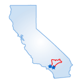 The Rim of World Scenic Byway aptly describes the drive along Southern California's highest mountain range, the San Bernardinos, with their spectacular view of the surrounding mountains as well as the Los Angeles Basin. Along the way, you'll pass several resort communities and wilderness areas, and you may even catch a little "gold fever" as you explore the remains of an abandoned 1860s mining town.
Start out on California Rte. 18 just north of San Bernardino at the entrance to San Bernardino National Forest. You'll cross the San Andreas Fault at the base of the mountain range. Though the fault rumbles daily, it's unlikely you'll be aware of the slight tremors. Once inside the national forest, the road begins a steep ascent, climbing to 4,000 feet in just eight miles. The Inspiration and Panorama overlooks will be your first photo stops, with their views of Waterman Canyon and surrounding mountains.
The adventuresome will take the two-mile drive up Bear Springs Road in Rimforest to climb Strawberry Peak Lookout, a fire lookout point which stands at the dizzying elevation of 6,153 feet. Back in the car, you'll soon come to the Heaps Peak Arboretum. A short hike through a densely forested area reveals some of the plant life native to California, including a small grove of giant sequoias planted in 1930 after a forest fire devastated the area in 1922. Imagine how large these spectacular trees will be when they reach maturity--in the year 3000 or so. After Heaps Peak, past Running Springs and Arrowbear Lake (small resort towns with restaurants and shops), take a detour up Forest Road at Deer Lick Ranger Station to the National Children's Forest. Planted by schoolchildren in the 1970s after a fire destroyed the original forest, it features handicapped-accessible trails with interpretive signs in braille. Back on California Rte. 18 going east, you'll pass several ski resorts, including Snow Valley and Rim Nordic Ski Area, which offer skiing until late March.
The Lake View Point overlook offers gorgeous views of Big Bear Lake and the San Gorgonio Wilderness Area. As you enter the resort community of Big Bear Lake, stop at the Big Bear Ranger Station and pick up a pamphlet for the self-guided auto tour of the Gold Fever Trail. The 1860s gold rush will come alive as you pass abandoned mines, cabins and a lone gravesite. A few miles beyond the ranger station, turn onto Rte. 38 south past 8,443-foot Onyx Summit, the highest peak of the drive. You'll also pass the San Gorgonio Wilderness Area, home to a wide variety of wildlife including Nelson bighorn sheep, mountain lions, and eagles. The driving tour concludes back at the San Bernardino National Forest.
Starting Point:
San Bernardino, CA
Distance of Drive:
85 miles
Must Eat:
Big Bear Mountain Brewery
40260 Big Bear Blvd, Big Bear Lake, CA 92315
Phone:��909-866-2337
Call ahead to confirm hours of operation.
Best Time of Year for Drive:
Early spring to late fall
Points of Interest on Drive:
National Children's Forest
8,443-foot Onyx Summit
Comments to this article have been disabled.